I did say I wouldn't squawk about this until Wednesday - but I can't ignore the 0z GFS...
That model indicates a SIGNIFICANT SNOWSTORM for Cincinnati come this weekend.
Here's the model at 126 hours (Click to enlarge...this will be the case for all of the images to follow, too):
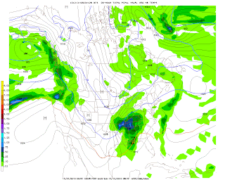
It depicts a low over Memphis, TN, measuring 996 millibars. Note the blue 0 line. That's the freezing level at about 5000 feet above earth. It's NORTH of us. Not precisely conducive to snow for Cincinnati, right? In fact this model indicates rain at this time.
At 132 hours:
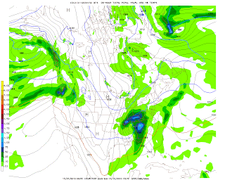
Note that the low has tracked to Nashville, TN, but is still 996 millibars. The 0 line is just outside Cincinnati to the south. Remember, that line being south favors snow.
At 138 hours:
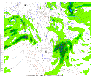
BULLSEYE. Notice the heaviest precipitation is DIRECTLY over Cincinnati. That would be 5-7.5" of snow in the previous 6 hours (from hour 132 to hour 138). The low has moved to roughly Bluefield, WV and has deepened to 992 millibars. Take note of the isobars (lines of equal pressure, which are labeled 992, 996, 1000, etc. on the map). Notice how tightly spaced they are...almost like a can of sardines, right? That indicates that winds will be strong out of the north. That 0 line is no problem - it's WAY south.
144 hours:
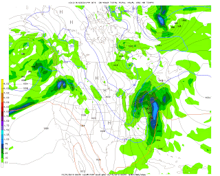
WOW. Look at the low, which in this image is now centered over southern PA. It's down to 984 millibars! That's strong...dropping 8 millibars over 6 hours. That, combined with the previous pressure drop from 996-992 means this storm is on its way to possible BOMBOGENESIS. The tri-state could still be seeing some light snow, up to an additional inch would accumulate.
I have to stop right here and answer a question likely on the mind of the reader. What is Bombogenesis? That is what happens when a storm experiences a rapid pressure drop of 24 millibars OR MORE in a 24 hour period. We went from 996 millibars to 984 millibars from 132 hours to 144 hours...so we're halfway there.
Just for kicks, let's look at 150 hours:
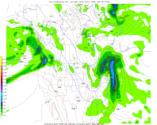
The low is now near Albany, NY...at 976 MILLIBARS! That's another 8 millibar pressure drop in six hours. Cincinnati is now out of any precipitation...but it's COLD.
And 156, just to see if we achieved a true meteorological "bomb":
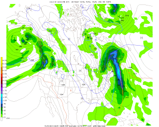
Nope. We just missed it by 4 millibars. It's still 976 millibars, and has moved to the ME/Quebec border region. But...note that 0 line. WAYYYY down into FLORIDA. At this point, if any precipitation fell in, say, Jacksonville, or Atlanta...it'd be SNOW.
Now, a caution: We're still 5 days from the event. This is going to change. But right now...just know that a potential exists for SIGNIFICANT snowfall on Sunday that could impact your plans over the weekend, including any events you may plan to attend.
No comments:
Post a Comment